
Category: Other Date:2024-05-23 10:00:01
Rating: 4.4
Scan to Download
Avia Maps Aeronautical Charts is an essential app for pilots and aviation enthusiasts around the world. Whether you're planning a flight or navigating in the air, this app has got you covered. With the ability to download relevant data for offline use, you can choose any 5 by 5 degree area on earth and access over 65,000 airports, 9,000 navaids, and 15,000 waypoints. The app also provides global, high-resolution weather forecasts, so you can stay updated on cloud cover, precipitation, and wind, even without cell reception. Safety is a priority with the app, as it allows you to display traffic information and supports receiving traffic data from ADS-B receivers or the SafeSky app. Additionally, the app offers accurate performance calculations, multiple aircraft profiles, and the ability to synchronize your data between devices. Try Avia Maps Aeronautical Charts today and experience all its incredible features for yourself!
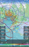
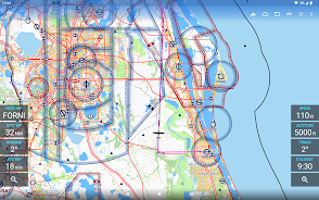
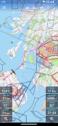
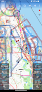
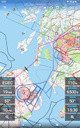
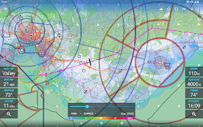
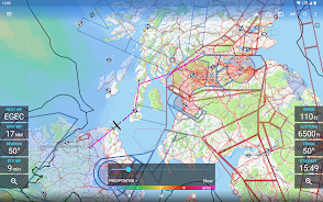
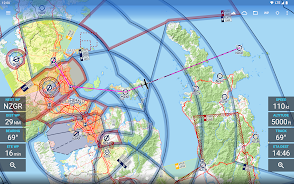
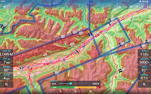
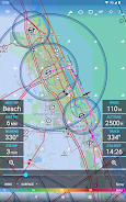
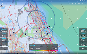
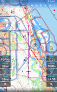
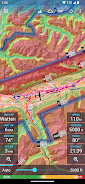
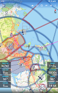
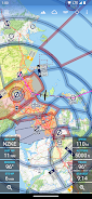
> Comprehensive aviation maps: The app provides reliable and straightforward aviation maps for pilots and aerospace enthusiasts around the world. It is suitable for pre-flight planning as well as in-flight navigation.
> Offline data download: Users can choose any 5 by 5 degree area on earth and download relevant data for offline use. This ensures that the app can be used even when there is no cell reception during flight.
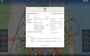
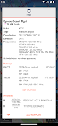
> Extensive airport and airspace information: The map features over 65000 airports, 9000 navaids, and 15000 waypoints globally. It also includes airspaces for 62 countries across all continents (excluding Antarctica). Users can easily access important information about airports and airspaces.
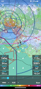
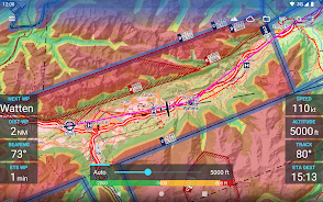
> Global weather forecasts: The app provides high-resolution weather forecasts from reliable sources such as the German DWD and US American NOAA. Users can view map layers for cloud cover, ceiling, precipitation, and wind on the ground and aloft. The weather data is downloaded onto the device for offline use.
> Traffic information integration: It can display traffic information from ADS-B receivers or the SafeSky app directly on the map. This feature enhances safety during flights by providing real-time traffic information.
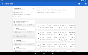
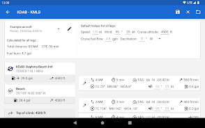
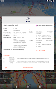
> Aircraft performance calculations: Users can create multiple aircraft profiles based on handbook values for climb performance, fuel consumption, etc. The app uses these profiles to calculate routes and considers engine type and fuel burn for climb performance. This feature ensures accurate performance calculations.
Avia Maps Aeronautical Charts App offers comprehensive and reliable aviation maps for pilots and aerospace enthusiasts worldwide. With features like offline data download, extensive airport and airspace information, global weather forecasts, traffic information integration, and accurate aircraft performance calculations, this app provides a valuable tool for pre-flight planning and in-flight navigation. Download now to enhance your aviation experience and ensure a safer and more efficient flight.
File size: 38.49 M Latest Version: 3.12.2
Requirements: Android Language: English
Votes: 436 Package ID: com.mytowntonight.aviamap


Comment