
Scan to Download
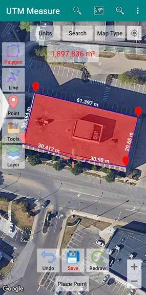
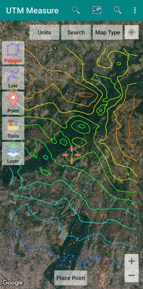
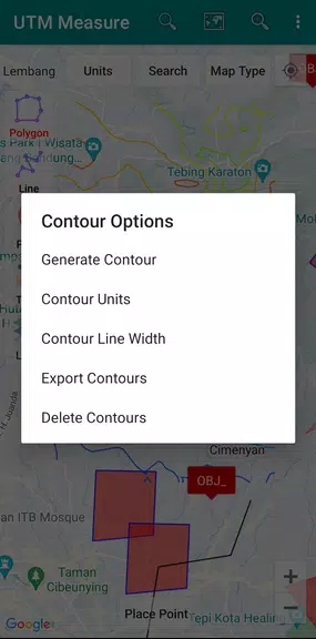
UTM Measure is a powerful app that allows users to measure area and distance, register points, lines, and polygons from Satellite Imagery map data or GPS data. With sophisticated spatial drawing and editing tools, users can easily perform simple spatial analyzes, overlays, buffering, and much more. The app also supports features such as contour lines and the ability to store an unlimited amount of data in your local database, including photos, labels, and notes. Export your data to KML, DXF, or CSV files, and work with Coordinate Reference Systems from around the world. Any suggestions for improvement are welcome, making this app a valuable tool for all your mapping needs.
- Powerful and Versatile Tools: UTM Measure offers a wide range of sophisticated spatial drawing and editing tools, allowing users to perform complex spatial analyses with ease.
- Customizable Data Storage: Users can store an unlimited amount of data in their local database, including feature names, photos, labels, and notes, providing a comprehensive and organized workspace.
- Export Functionality: Easily export your data to KML, DXF, or CSV files for seamless integration with other software and platforms.
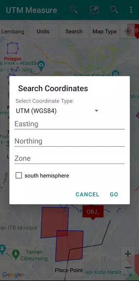
- Global Coordination Support: UTM Measure supports Coordinate Reference Systems from around the world, making it easy to plot polygons on a map based on various local CRS using EPSG Code.
- Is UTM Measure suitable for beginners?
UTM Measure is designed to be user-friendly, with intuitive tools and functionalities, making it suitable for users of all levels of expertise.
- Can I use UTM Measure offline?
Yes, UTM Measure allows you to work offline, providing flexibility and convenience for users in areas with limited internet connectivity.
- Can I customize the appearance of my maps in UTM Measure?
Yes, UTM Measure offers customization options for map appearance, allowing users to tailor their workspace to their preferences and needs.
UTM Measure is a comprehensive and versatile tool for spatial analysis and data management, offering powerful features, intuitive user interface, and global coordination support. Whether you are a beginner or an experienced GIS professional, UTM Measure provides the tools and functionalities you need to create, edit, and analyze spatial data effectively. With its customizable data storage and export capabilities, UTM Measure is a valuable asset for a wide range of users in various industries. Download UTM Measure now and take your spatial analysis to the next level.
File size: 10.10 M Latest Version: 1.9.0
Requirements: Android Language: English
Votes: 270 Package ID: com.yogantara.measure
Developer: Y2 Tech

Level up your phone with the most helpful tools for Ultimate productivity. From image editors and file managers to task trackers and weather widgets, these top-rated essentials make everyday tasks smooth and easy. Get organized, save time and optimize workflows with a powerful toolbox by downloading these editor's choice utilities today. Your phone will never be the same again!


Comment