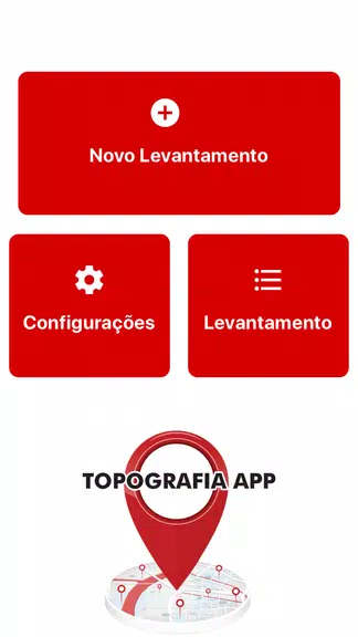
Looking for an efficient way to georeference and survey land? Look no further than the Topography App! With features like designing electrical networks, streets, and subdivisions, this app is a great tool for all your surveying needs. Easily export your surveys to DXF, KML, or CSV formats for seamless integration with other software. In the Professional version, mark up to 5000 points for even more detailed surveys. Say goodbye to tedious paperwork and hello to streamlined data collection with the Topography App. Start optimizing your surveying process today!
> Seamless integration: The Topography App allows users to effortlessly export their surveys to popular file formats such as DXF, KML, and CSV. This seamless integration with widely-used programs like AutoCAD and Google Earth ensures that your survey data can be easily shared and utilized across different platforms.
> Versatile functionality: With the Topography App, users can design electrical networks, avenues, streets, subdivisions, and conduct various land surveying studies. The app's diverse range of functionalities makes it a valuable tool for professionals in various industries like architecture, civil engineering, and urban planning.
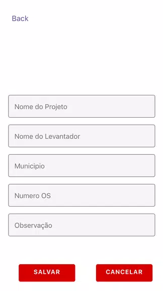
> User-friendly interface: The Topography App boasts a user-friendly interface that is easy to navigate, even for beginners. Its intuitive design and user-friendly features make it easy for users to create accurate surveys and drawings without any technical expertise.
> Enhanced productivity: By using the Topography App, professionals can mark up to 5000 points for their surveys in the Professional version. This high point limit enables users to conduct comprehensive and detailed surveys with ease, enhancing their productivity and efficiency.
> Utilize the export feature: Take advantage of the app's export feature to easily share your survey data with colleagues, clients, or team members. This feature allows you to transmit your surveys via email directly from the field to the office, streamlining the communication process.
> Explore the various design tools: Experiment with the app's design tools to create detailed and accurate surveys of electrical networks, streets, and other topographical features. Familiarize yourself with the different functionalities of the app to maximize its potential for your projects.
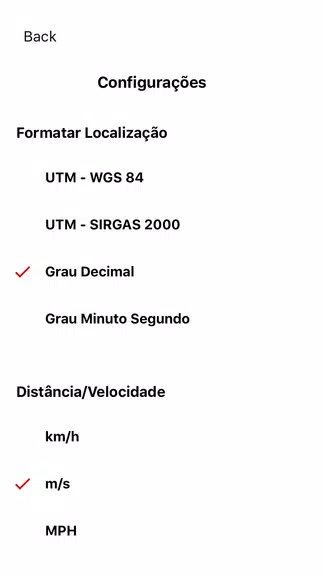
> Customize your surveys: Tailor your surveys to meet the specific requirements of your projects by customizing the settings and parameters in the Topography App. Adjust the survey settings to match the scale, scope, and complexity of your project to ensure precise and reliable results.
In conclusion, the Topography App offers a comprehensive solution for georeferencing, land surveying, and design projects. With its seamless integration, versatile functionality, user-friendly interface, and enhanced productivity features, the app is a valuable tool for professionals in various industries. By utilizing the app's export feature and design tools, users can create detailed surveys, share data effortlessly, and maximize their productivity. Whether you are an architect, civil engineer, or urban planner, the Topography App is a must-have tool for your professional endeavors. Click to download the Topography App and unlock its full potential today.
File size: 33.30 M Latest Version: 3.0.8
Requirements: Android Language: English
Votes: 257 Package ID: aguiar.com.br.point_gps
Developer: Aguiar Engenharia Inteligente

Level up your phone with the most helpful tools for Ultimate productivity. From image editors and file managers to task trackers and weather widgets, these top-rated essentials make everyday tasks smooth and easy. Get organized, save time and optimize workflows with a powerful toolbox by downloading these editor's choice utilities today. Your phone will never be the same again!


Comment